#include <wpsapi.h>
Public Attributes | |
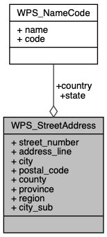
| char * | street_number |
| char ** | address_line |
| char * | city |
| char * | postal_code |
| char * | county |
| char * | province |
| WPS_NameCode | state |
| char * | region |
| WPS_NameCode | country |
| char * | city_sub |
Detailed Description
Street Address
- Note
- Some map data © OpenStreetMap contributors, CC-BY-SA.
Member Data Documentation
◆ address_line
| char** WPS_StreetAddress::address_line |
A NULL terminated array of address line
◆ city
| char* WPS_StreetAddress::city |
Represents the larger city layer which can be defined as the urbanized region around major metropolitan areas.
Unlike city_sub, this city region is not specifically delineated by jurisdictional boundaries but instead is influenced by the access point density detected by Skyhook's systems.
Specifically in areas where Skyhook has good postal code coverage, city often resolves to the formal name of that postal region. This is most typical in the U.S., Canada, Australia, and other major European countries.
- See also
- city_sub
◆ city_sub
| char* WPS_StreetAddress::city_sub |
Represets the second city layer that usually includes smaller township or municipal names found within the larger city region.
Unlike city, this geospatial layer is sourced from open-source data without modification and it more closely aligns with general jurisdictional and town boundaries.
- See also
- city
◆ country
| WPS_NameCode WPS_StreetAddress::country |
country, includes country name and 2-letter code.
◆ county
| char* WPS_StreetAddress::county |
county
◆ postal_code
| char* WPS_StreetAddress::postal_code |
postal code
◆ province
| char* WPS_StreetAddress::province |
province
◆ region
| char* WPS_StreetAddress::region |
region
◆ state
| WPS_NameCode WPS_StreetAddress::state |
state, includes state name and 2-letter code.
◆ street_number
| char* WPS_StreetAddress::street_number |
street number
The documentation for this struct was generated from the following file:
- include/api/wpsapi.h